Construction Site Aerial Surveying in Acadiana, LA
Construction site aerial surveying Acadiana contractors trust can turn weeks of manual measurements into a single afternoon of drone flight time. For builders, developers, and property owners across the Acadiana Area in Louisiana, aerial data delivers faster surveys, clearer progress records, and safer site documentation than ground-based methods alone. Acadiana SkyShots, a drone photography and videography company based in New Iberia, provides this kind of aerial construction support so clients can monitor, measure, and showcase their projects from the sky.
Quick answer: Construction site aerial surveying in Acadiana uses a drone to capture overhead photos, video, and location-tagged data of a job site, helping project teams track progress, flag issues early, and keep a visual record without extra ground crew time.
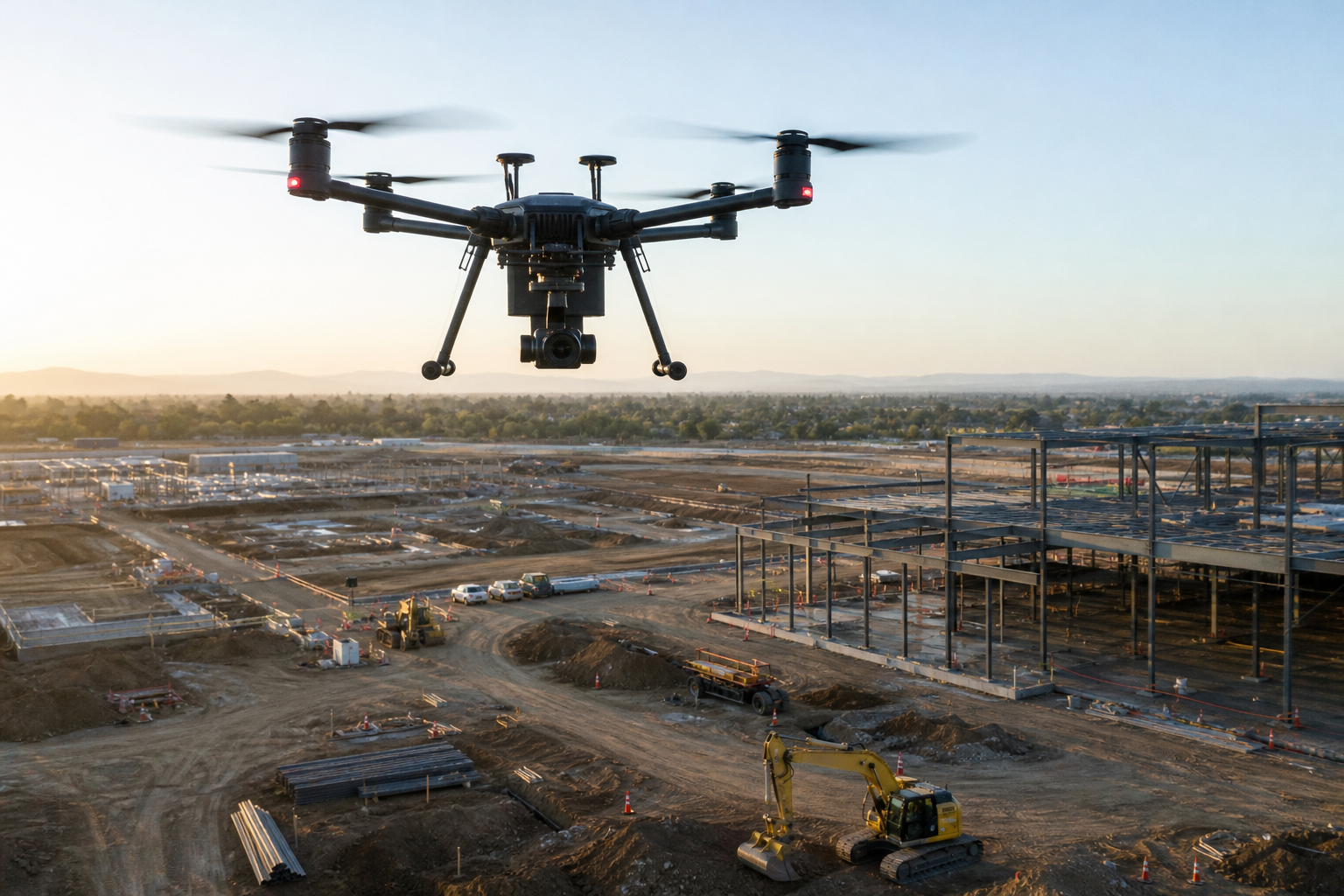
Construction site aerial surveying Acadiana teams rely on to track daily progress from above.
What Is Construction Site Aerial Surveying?
Construction site aerial surveying is the use of a drone, also called an unmanned aerial vehicle, to fly over a job site and capture photos, video, and location-tagged data from above. This information helps project teams see the full layout of a site, measure stockpiles or grading, and compare conditions across different phases of a build.
Unlike a single ground photo, an aerial pass shows the entire footprint of a project at once. Consequently, builders can spot drainage problems, material placement issues, or access bottlenecks before they turn into costly delays. For a broader look at how aerial tools apply across different project types, this guide to choosing the right aerial photography service breaks down the options side by side.
Why This Matters for Acadiana Builders
In particular, Acadiana's mix of flat coastal land, active commercial corridors, and residential growth means project managers often juggle multiple sites at once. As a result, aerial data gives a fast way to check on several locations without driving between each one every day.
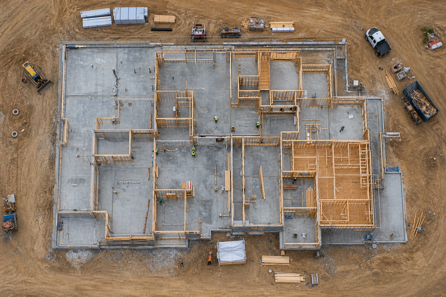
Overhead views like this support ongoing construction progress monitoring throughout a build.
Why Builders Choose Aerial Surveying for Construction Sites
Builders across the region turn to aerial surveying for construction sites because it saves time and reduces risk. Instead of sending crew members onto scaffolding or near heavy equipment just to take a photo, a drone pilot can capture the same view from a safe distance. According to the Federal Aviation Administration, more than 1 million drones are registered for use in the United States, reflecting how widely this technology has been adopted across industries, including construction.
In addition, aerial imagery creates a visual paper trail. For example, if a dispute arises about site conditions on a specific date, dated aerial photos can help clarify what was actually in place. Similarly, lenders and insurers sometimes request progress documentation, and aerial photo sets make that request easy to fulfill.
Common Use Cases on Louisiana Job Sites
- Tracking grading, drainage, and site prep before vertical construction begins
- Documenting framing and structural milestones for lenders or ownership groups
- Monitoring material stockpiles and equipment placement across large sites
- Capturing final exterior footage for marketing once a project is complete
How Construction Site Aerial Surveying Works in Acadiana
Setting up a reliable aerial survey process does not have to be complicated. Below is the basic sequence Acadiana SkyShots follows for most construction clients.
- Define survey goals and site boundaries. Share your project address, site boundaries, and the main reason for the survey, such as progress tracking, volume checks, or safety documentation, during a free consultation call.
- Schedule the flight around site activity. Coordinate a flight window that avoids active crane operations or crew movement, and confirm site access, parking, and any required safety briefings with the project supervisor.
- Capture aerial imagery and GPS-tagged data. The drone pilot flies a planned pattern over the site, capturing high-resolution photos, video, and location-tagged data points needed for mapping or progress comparison.
- Process data into maps and progress reports. Raw footage and imagery are reviewed and organized into usable formats, such as progress photo sets, flyover video, or basic site maps for project tracking.
- Review deliverables and plan the next visit. Review the delivered files with your project team, then schedule follow-up flights at key milestones to build a consistent visual record of construction progress.
Because every project differs, flight frequency often adjusts as a build moves from site prep to finishing work. Therefore, many clients start with a single flight and expand to a regular schedule once they see the value in the data.
Benefits of Drone-Based Construction Progress Monitoring
Drone-based construction progress monitoring offers several practical advantages over occasional site visits. Above all, it creates consistency. Instead of relying on memory or scattered phone photos, a scheduled flight plan produces a dated, comparable record every time.
Furthermore, aerial footage gives stakeholders who are not on-site, such as out-of-town investors or busy homeowners, a clear way to see how work is progressing. This is especially useful for insurance agents and builders who need visual proof of conditions at a specific stage. For a deeper look at the broader technology behind these services, the Wikipedia overview of unmanned aerial vehicles explains how this equipment has evolved for commercial use.
Reducing Risk and Equipment Downtime
Climbing scaffolding or pausing equipment to get a manual measurement takes time and introduces risk. In contrast, a drone flight can capture the same information in minutes without interrupting active work. As a result, crews keep moving while still generating the visual data a project needs.
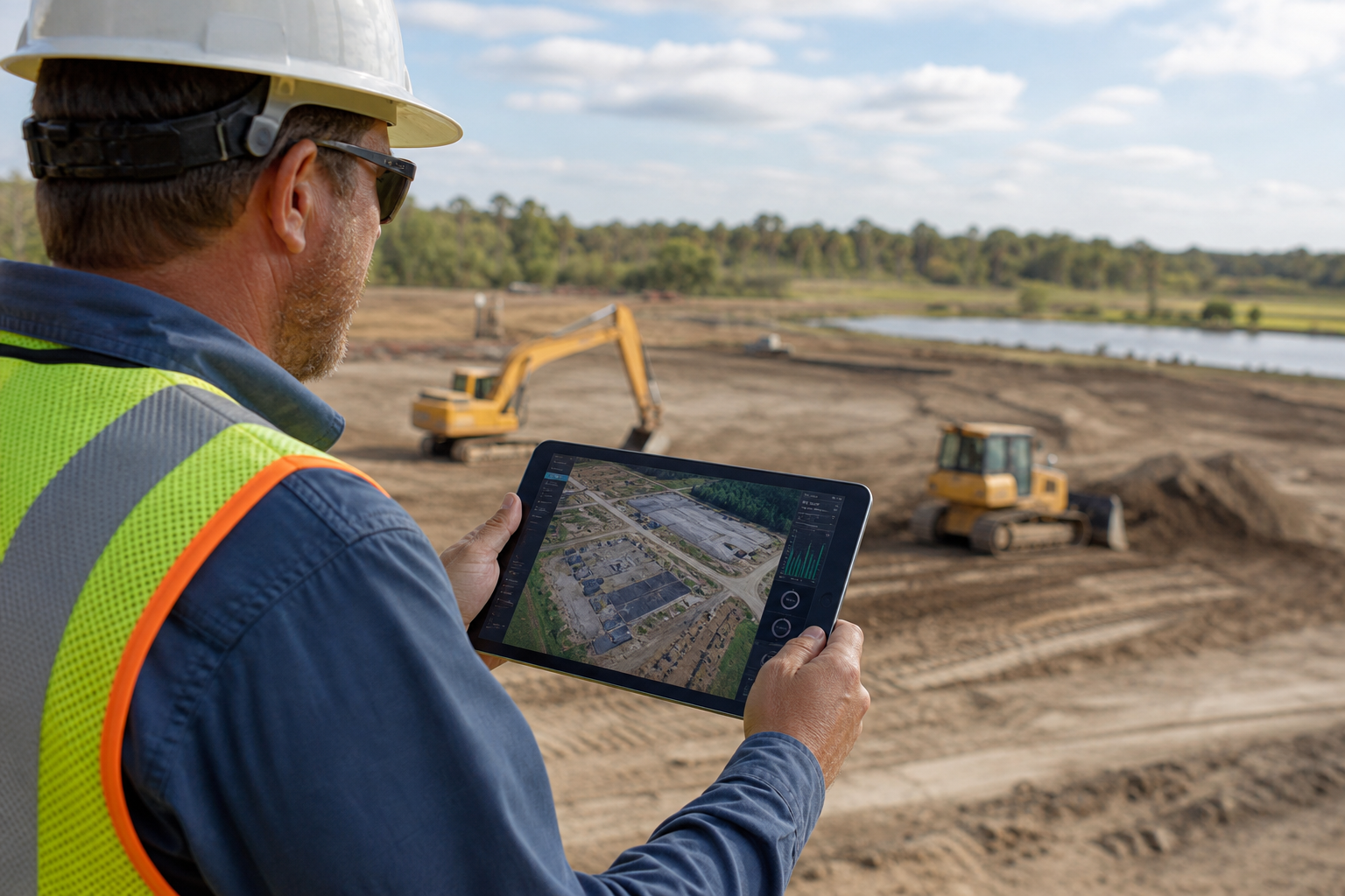
Reviewing flight data on-site helps confirm progress before the next scheduled survey.
Aerial Construction Support Beyond Surveying
Aerial construction support goes beyond a single survey flight. It typically includes ongoing project monitoring, safety and inventory visibility, and general surveying assistance that supports the broader needs of a job site. For instance, project managers can use aerial footage to confirm material deliveries are stored correctly or that equipment is positioned safely away from active work zones.
Specifically, this kind of support is detailed on the aerial construction support services page, which outlines how ongoing monitoring fits into active builds. Likewise, teams working on inspection-heavy projects may benefit from pairing surveying flights with dedicated drone inspection services in New Iberia and Acadiana for a more complete visual record.
Supporting Real Estate and Hospitality Projects
Once a build nears completion, aerial footage also supports marketing. Builders and real estate professionals often transition straight from progress monitoring into finished-property photography, while hotels and resorts use similar footage to showcase amenities. If your project will need that kind of visual marketing afterward, this hotel aerial photography overview shows how the same drone technology applies once construction wraps up.
Choosing an Aerial Surveying Partner in the Acadiana Area
Not every drone operator is set up for construction work. Above all, you want a provider who understands site safety, flight planning around active equipment, and how to deliver usable files quickly. Acadiana SkyShots, located at 1714 Dublin St in New Iberia, Louisiana, is a member of the Sky Eye Network and offers construction site aerial surveying Acadiana builders can schedule alongside inspections, real estate marketing, and project documentation.
The company serves New Iberia, Lafayette, Broussard, Patterson, Lake Charles, Jennings, Morgan City, Eunice, Opelousas, Sunset, Alexandria, and Baton Rouge, with additional areas considered depending on the job. For readers comparing drone technology options before booking a flight, this unmanned aerial vehicle guide for Acadiana properties explains the basics in plain terms. Operators flying commercially also follow FAA Part 107 certification rules, which set the safety standards for drone flights near job sites.
Questions to Ask Before You Book
Before scheduling a survey, ask how long the flight will take, what file formats you will receive, and how pricing works for repeat visits. In addition, confirm whether the operator carries insurance and holds the proper FAA certification for commercial flights. A quick call, such as the free consultation offered through Acadiana SkyShots, is usually enough to answer these questions and set a timeline for your project.
Ready to get started? Call (337) 352-6234 to schedule a free consultation for construction site aerial surveying, aerial inspections, or progress monitoring anywhere in the Acadiana Area.
Frequently Asked Questions About Construction Site Aerial Surveying Acadiana
What is construction site aerial surveying Acadiana contractors use?
Construction site aerial surveying Acadiana contractors use is the practice of flying a drone over a job site to capture images, video, and GPS-tagged data that document site conditions, elevations, and progress. It gives builders a fast, visual way to track changes over time without walking the entire site.
How much does aerial construction surveying cost in Acadiana?
Pricing depends on site size, flight frequency, and the type of deliverables you need, such as maps, video, or progress photo sets. Acadiana SkyShots offers a free consultation to review your project and provide a clear quote before work begins.
How long does a drone survey of a construction site take?
Most single-site flights take between 20 and 60 minutes, depending on acreage and the level of detail required. Larger commercial sites or multi-phase builds may need longer sessions or recurring scheduled visits.
What is the difference between aerial surveying and traditional ground surveying?
Traditional ground surveying relies on crews walking the site with equipment, while aerial surveying captures the same area from above in a fraction of the time. Aerial data also shows the full site context, which is harder to see from ground level alone.
Can drone surveys replace a licensed land surveyor?
Drone surveys complement, rather than replace, licensed land surveying for legal boundary determinations. They are best used for progress monitoring, visual documentation, and general site mapping alongside certified survey work.
How often should construction progress be documented with aerial photography?
Many Acadiana builders schedule flights weekly, biweekly, or at key project milestones such as foundation, framing, and completion. A consistent schedule creates a visual timeline that is useful for clients, lenders, and insurance records.
What areas does Acadiana SkyShots serve for construction support?
Acadiana SkyShots serves New Iberia, Lafayette, Broussard, Patterson, Lake Charles, Jennings, Morgan City, Eunice, Opelousas, Sunset, Alexandria, Baton Rouge, and the broader Acadiana Area in Louisiana. Additional service areas may be considered depending on the job.
What is included in an aerial construction support service?
Aerial construction support typically includes project monitoring, safety and inventory visibility, and surveying assistance captured from above. These visuals help project managers track material placement, equipment positioning, and overall build progress.
Do I need a free consultation before scheduling a drone survey?
A free consultation helps match the right flight plan and deliverables to your project goals and timeline. It also gives you a chance to ask about pricing, scheduling, and site access requirements before committing.
What safety considerations apply to drone flights near construction equipment?
Drone pilots coordinate flight paths and altitude around cranes, scaffolding, and active work zones to avoid interference with crews and equipment. This approach can reduce the need for workers to access elevated or hazardous areas simply to capture visual records.
What file formats are delivered after an aerial survey?
Deliverables commonly include high-resolution photos, video footage, and site maps in standard formats compatible with most project management and design software. Specific format needs can be discussed during your consultation.
Why choose a Sky Eye Network member for construction aerial surveying?
Sky Eye Network membership connects a drone operator to a broader network of trained aerial professionals and shared best practices. Acadiana SkyShots is a member of this network, which supports consistent quality across aerial photography and inspection projects.
Final Thoughts on Aerial Surveying for Acadiana Job Sites
Construction site aerial surveying Acadiana builders rely on is becoming a practical, affordable way to keep projects on track. From early site prep through final marketing photos, drone data gives project teams a consistent view of progress, safety conditions, and site layout that ground photos simply cannot match. As more contractors, realtors, and insurance professionals across Louisiana adopt this technology, the ability to document a build clearly and quickly has become a competitive advantage rather than a luxury.
In summary, whether you need a single flyover before a milestone inspection or a recurring progress monitoring schedule, construction site aerial surveying Acadiana teams offer can be tailored to your project's size and timeline. Acadiana SkyShots welcomes calls from builders, roofing companies, insurance agents, and property owners throughout the Acadiana Area who want clear, dependable aerial data. Call (337) 352-6234 today to schedule a free consultation and see how drone-based surveying fits your next project.