

Aerial photography has become one of the fastest ways for Acadiana businesses, real estate agents, and property owners to show off a project from angles that ground-level cameras simply cannot reach. Whether you need a sweeping shot of a new listing, documentation of construction progress, or footage for a wedding reception, a trained drone pilot can capture it safely and efficiently. In this guide, we will break down how to choose the right type of aerial photography service for your specific project, what drives pricing, and the questions you should ask before hiring a provider in the Acadiana Area in Louisiana.
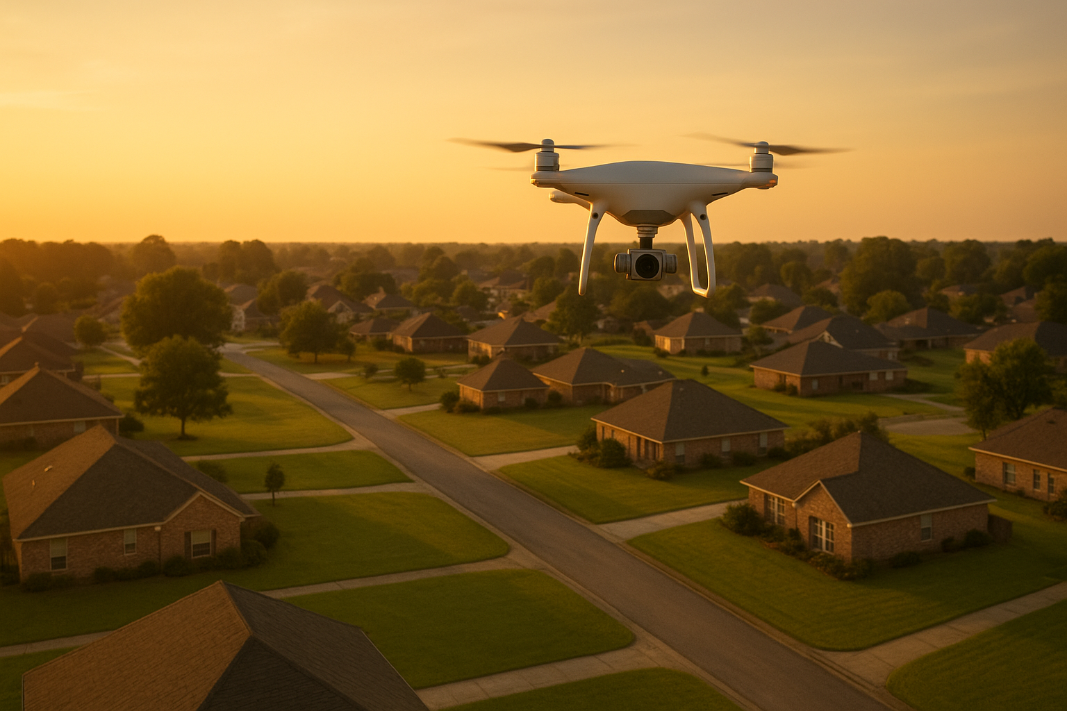
Aerial photography captures scale and context that ground-level shots cannot show.
What Is Aerial Photography?
Aerial photography is the practice of capturing still images or video from an elevated vantage point, typically using a drone, to show a property, site, or event from above. Unlike a ladder or a tall tripod, a drone can move freely through the air, which means a pilot can frame a shot exactly the way a project needs it framed.
In short, if you have ever wished a viewer could see your home, job site, or venue the way a bird sees it, that is exactly what this service provides. According to Wikipedia's overview of aerial photography, the practice dates back to balloon-mounted cameras in the 1800s, long before modern drones made it accessible and affordable.
Why Aerial Imagery Outperforms Ground-Level Shots
Ground-level photos can only show so much. A single wide-angle lens cannot capture an entire property line, a roofline, or the full scope of a construction site. Aerial imagery, by contrast, shows the whole picture in one frame, which is especially useful when buyers, inspectors, or project managers need context quickly.
Consequently, demand for drone-based visuals has grown steadily. The Federal Aviation Administration (FAA) reports that more than one million drones are now registered in the United States for recreational and commercial use, a figure that reflects just how common drone-based services like aerial photography have become. For more detail on commercial drone rules, see the FAA's commercial operator guidance.
In addition, because a drone can capture both wide establishing shots and close-up detail in the same flight, it often replaces several pieces of traditional equipment, including tall ladders, scissor lifts, and even helicopters for smaller jobs.
Choosing the Right Aerial Photography Service for Your Project
Not every project needs the same type of aerial photography. Therefore, the first step is matching the service to your actual goal, whether that is selling a home, tracking a build, or documenting a special day. Below is a breakdown of the most common project types and what each one typically involves.
Aerial Real Estate Photography for Listings
Real estate agents and homeowners often use aerial real estate photography to showcase a property's lot size, layout, and surrounding neighborhood in a single image. For example, a buyer scrolling through listings online can instantly understand a property's proximity to water, roads, or green space without visiting in person.
Aerial Construction Support and Surveying
Builders and contractors rely on aerial construction support for project monitoring, safety and inventory visibility, and surveying throughout a build. Because drone flights can be repeated on a schedule, project managers get a consistent visual record of progress from groundbreaking through completion.
Aerial Inspections for Safety and Maintenance
Roofing companies, insurance agents, and property owners often turn to aerial inspections to check roofs, towers, or large structures without climbing ladders or hiring heavy equipment. As a result, inspection teams can reduce physical risk while still gathering the visual data they need to assess damage or wear.
Weddings, Films, and Special Events
Beyond business use, aerial photography and drone videography have become popular for weddings and independent film projects across the Acadiana Area. A single aerial pass over a ceremony or outdoor venue can add a cinematic feel that ground cameras alone cannot achieve.
Hotels, Resorts, and SceneScape 360
Hotels and resorts increasingly use aerial imagery paired with immersive tools like SceneScape 360 to give potential guests a virtual walkthrough of grounds, pools, and nearby attractions. This combination helps hospitality businesses stand out in a crowded booking market.
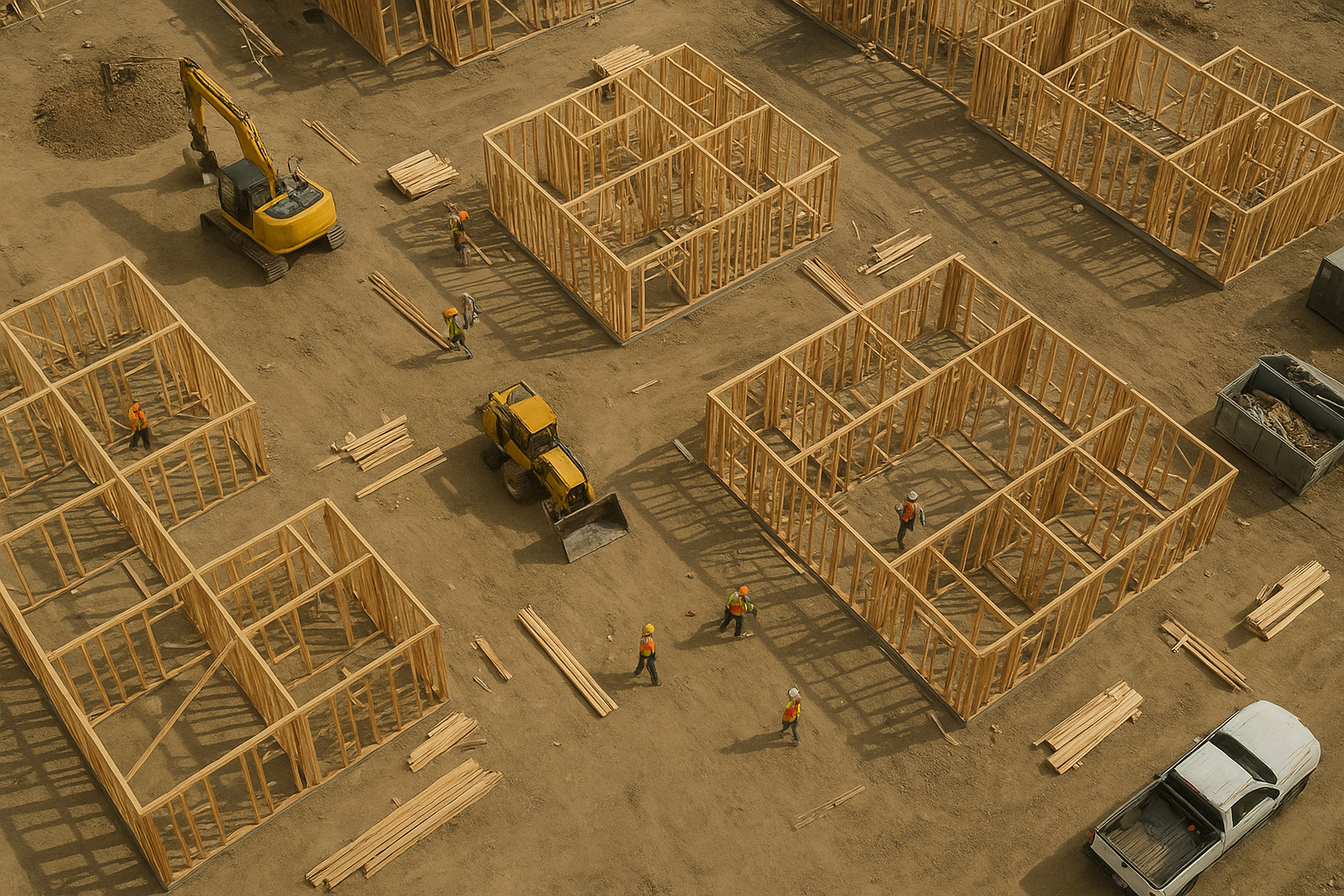
Construction teams use repeated aerial flights to track progress over time.
How to Book a Drone Photography Session in Acadiana
Once you know which service fits your project, booking is a straightforward process. Here is the general sequence most clients follow when scheduling a session.
- Define your project goals. Decide what you need the aerial photography for, such as a real estate listing, construction update, inspection, or wedding, and list the specific deliverables you want, like photos, video, or a 360 tour.
- Request a free consultation. Contact a local provider to discuss your timeline, site location, and access requirements so they can plan the flight and confirm it fits your schedule and budget.
- Confirm FAA compliance and airspace clearance. Verify that the pilot holds an FAA Part 107 certificate and check whether your property sits near restricted airspace that may require additional authorization before flying.
- Schedule the flight around weather and lighting. Pick a date with favorable weather and plan for golden hour or midday light depending on your goals, since lighting conditions strongly affect the quality of aerial photography results.
- Review deliverables and request edits. Once the aerial photos and videos are delivered, review them against your original goals and request additional angles or edits if something important was missed during the shoot.
What Affects Aerial Photography Pricing?
Several factors influence how much a session costs, and understanding them helps you set realistic expectations before requesting a quote. For a deeper breakdown of pricing structures, see this detailed aerial photography drone guide covering costs, uses, and tips.
In particular, project type matters most. A quick residential listing shoot generally takes less time than a multi-acre construction survey or a full-day event. Location also plays a role, since travel distance across the Acadiana Area can affect scheduling. Finally, deliverables such as edited video, 360 tours, or rush turnaround typically add to the overall cost. For a closer look at the booking process itself, this guide on aerial photos in Acadiana covering pricing and process tips walks through what to expect step by step.
Questions to Ask Before Hiring a Drone Photography Provider
Before committing to a provider, it helps to ask a short list of questions. For instance, confirm whether the pilot is FAA Part 107 certified, since this is legally required for any commercial drone work in the United States. Additionally, ask about insurance coverage, turnaround time for edited files, and whether the provider has experience with your specific project type, whether that is real estate, construction, or event coverage.
Moreover, it is worth asking how weather delays are handled, since outdoor flights depend heavily on wind and visibility. A provider who explains this clearly upfront is generally easier to work with when scheduling changes come up.
Why Choose Acadiana SkyShots for Your Aerial Photos and Videos
Acadiana SkyShots is based in New Iberia, Louisiana, and provides professional drone-based aerial photography and videography for businesses, property professionals, and individual projects. Services include aerial real estate photography, aerial inspections, aerial construction support, SceneScape 360, and coverage for hotels and resorts, along with weddings and independent films.
As a member of the Sky Eye Network, Acadiana SkyShots serves clients throughout Lafayette, New Iberia, Broussard, Patterson, Lake Charles, Jennings, Morgan City, Eunice, Opelousas, Sunset, Alexandria, and Baton Rouge. Realtors can also ask about a free aerial photo shoot offer for eligible listings. You can learn more about available packages on the services page or review service details specific to aerial drone photography services in New Iberia, LA.
To discuss your project, timeline, and budget, call (337) 352-6234 to schedule a free consultation, or visit the Acadiana SkyShots homepage for more information.
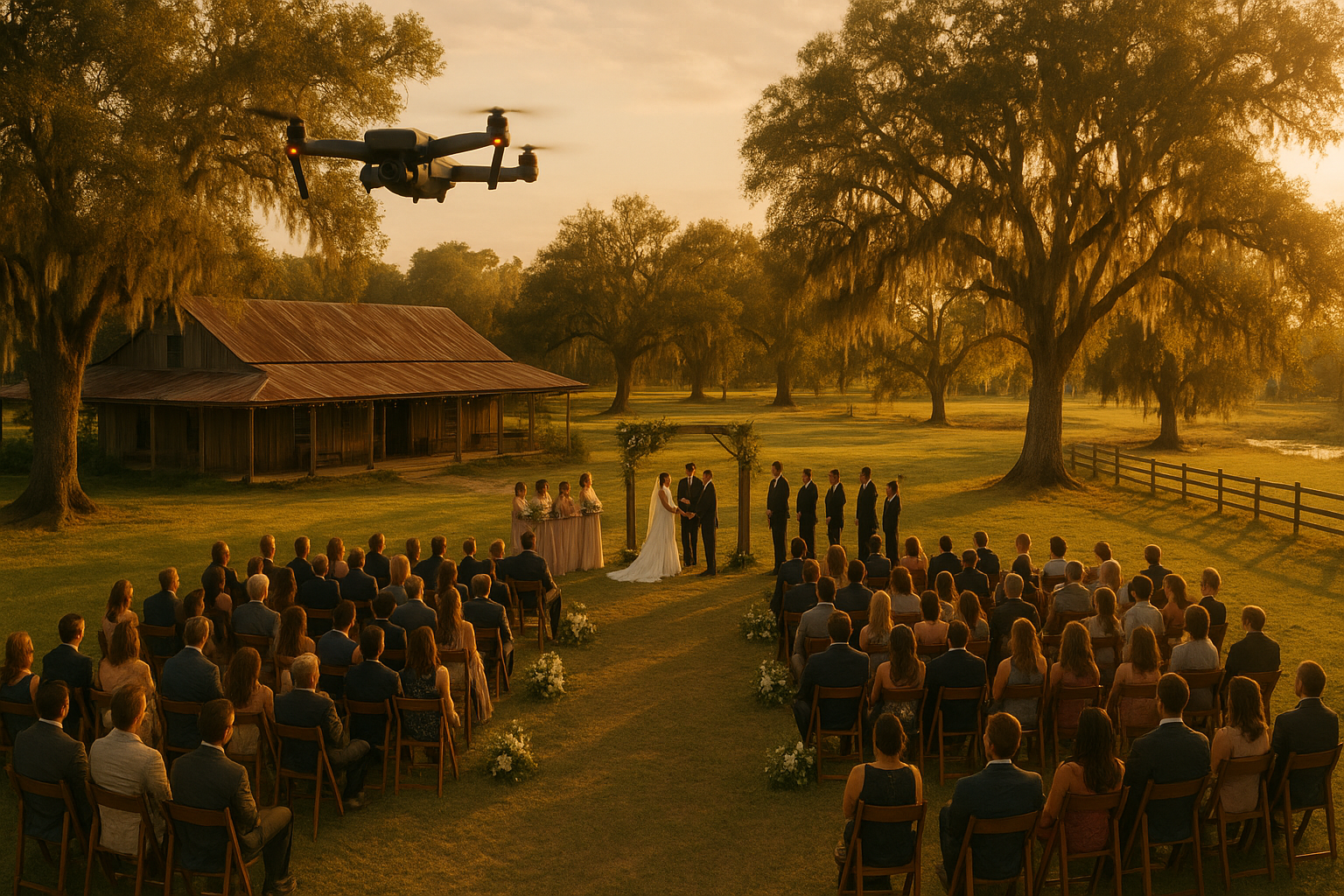
Aerial photography adds a cinematic perspective to weddings and outdoor events.
Frequently Asked Questions About Aerial Photography
What is aerial photography?
Aerial photography is the practice of capturing still images or video from an elevated position, usually with a drone, to show a property, site, or event from above. It gives viewers context and scale that ground-level photos cannot provide.
How much does aerial photography cost in Acadiana?
Pricing depends on the project type, location, flight time, and deliverables requested, such as photos, video, or a 360 virtual tour. Contacting a local provider for a free consultation is the most reliable way to get an accurate quote.
How long does an aerial photography session take?
Most residential real estate shoots take between 30 and 60 minutes on site, while construction or inspection projects can run longer depending on the size of the area. Weather and lighting conditions can also affect total time.
What is the difference between aerial photography and drone videography?
Aerial photography refers to still images captured from the air, while drone videography captures moving footage, often including smooth pans and reveal shots. Many providers offer both as part of the same session.
Do I need a permit for aerial photography?
Commercial drone pilots in the United States must hold an FAA Part 107 Remote Pilot Certificate rather than a separate permit for each job. Some locations, such as airport proximity zones, may require additional airspace authorization.
What common mistakes should I avoid when hiring a drone photographer?
A common mistake is hiring an uncertified operator who cannot legally fly for business purposes under FAA rules. Another is skipping a pre-shoot conversation about goals, which can lead to footage that does not match your marketing needs.
Can aerial photography help sell a home faster?
Aerial photography can make a listing stand out by showing the property, lot size, and surrounding area in one clear image. While results vary by market, many agents use it as a standard marketing tool for competitive listings.
What is included in aerial construction support?
Aerial construction support typically includes progress monitoring, safety and inventory visibility, and aerial surveying over the course of a project. These visuals help project managers track milestones without relying as heavily on ground equipment.
Are aerial inspections safer than traditional inspections?
Aerial inspections can reduce the need for ladders, lifts, or scaffolding in hard-to-reach areas like rooftops and towers. This generally lowers physical risk to inspection personnel while still delivering usable visual data. For broader safety context, the Occupational Safety and Health Administration (OSHA) outlines fall-related risks tied to ladder and roof work.
Can aerial photography be used for weddings and events?
Yes, aerial photography is increasingly popular for weddings, outdoor ceremonies, and independent film projects. A drone can capture sweeping establishing shots that complement traditional ground photography.
What is SceneScape 360?
SceneScape 360 is a service offering from Acadiana SkyShots that creates immersive 360-degree views of a property or location. It is often used by hotels, resorts, and businesses that want an interactive virtual walkthrough.
How do I prepare my property for an aerial photography shoot?
Clear vehicles, equipment, and clutter from the areas you want highlighted, and mow or tidy outdoor spaces if possible. Sharing your goals and desired angles with your pilot ahead of time also helps the shoot run smoothly.
Final Thoughts
Ultimately, choosing the right aerial photography service comes down to matching the capability to your project, whether that means a real estate listing, a construction timeline, a safety inspection, or a memorable event. As this guide shows, aerial photography is flexible enough to serve businesses, property professionals, and individuals across the Acadiana Area in Louisiana, and the right provider can help you plan around weather, FAA requirements, and deliverables before the drone ever takes off. If you are ready to move forward, contact Acadiana SkyShots at (337) 352-6234 to schedule a free consultation and discuss which aerial photography option fits your project best.


